Collaborative Management
The mandate of the Planning Board is related to the collaborative management of water flows from the principal reservoirs for the purpose of reducing the impacts of flooding and droughts in the watershed. Therefore, it is essential to have a good understanding of flooding and droughts in the basin.
Why can Flooding Occur?
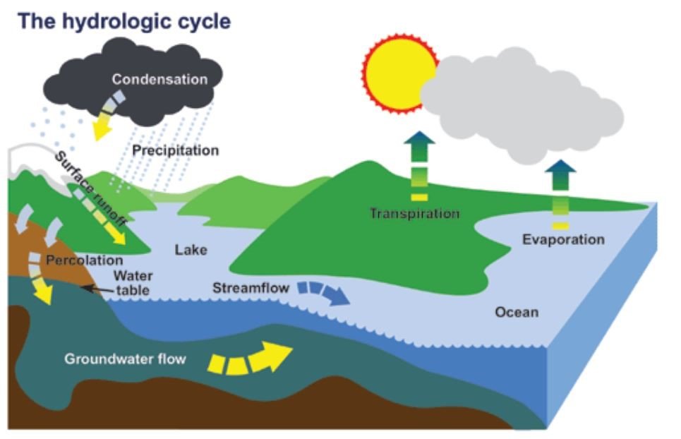
During the Canadian winter, most precipitation is stored as snow or ice on the ground. During the spring melt, large quantities of water are released. This water can combine with rainfall, which typically leads to increased spring flows. This is called freshet.
In spring, the soil is saturated and still partly frozen. When the snow rapidly melts, there is little opportunity for the water to be absorbed. A large portion of the water contained in the snow ends as runoff. Sometimes, rainfall occurs at the same time as the snowmelt. Combined, the water runs off on the ground surface to low-lying areas and streams.
Runoff in the Ottawa River basin, a land area twice the size of New Brunswick, eventually drains to the river. When rain falls on the watershed during the freshet, a significant portion of that rainwater drains into the river itself. For example, if 50 mm of rainfall were to be received over much of the watershed, the bulk of this rainfall would runoff to the Ottawa River. This runoff from the rainfall would represent an extra volume of 3,650 million cubic metres of water. That extra water added to the Ottawa River would be more water than 1,000,000 filled Olympic-sized swimming pools.
Flooding occurs when the volume of water flowing in a river or stream exceeds the capacity of the channel. Snowmelt runoff floods are the most common type of flooding in Canada. Click here for more information about snowmelt runoff.
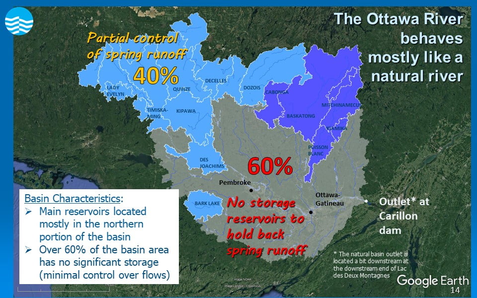
Flooding can occur on the main stem of the Ottawa River under two circumstances.
- In 40% of the watershed that drains to principal reservoirs, the spring runoff is more than the principal reservoirs can retain:
- Water from approximately 40% of the watershed total area drains into principal reservoirs as shown in the figure below.
- Each year, the principal reservoirs are emptied over the course of winter. They are then filled during the spring period over several weeks and sometimes months.
- Once they are full and have run out of storage space, principal reservoirs must pass the inflows they receive to downstream areas, which can cause flooding.
- In the remaining 60% of the watershed, there is significant spring runoff, as there are no reservoirs to contain and help manage spring runoff in this part of the watershed:
- Water from approximately 60% of the watershed total area drains directly into the Ottawa River and its tributaries as shown in the figure below.
- Dam facilities on the Ottawa River in the central and southern parts of the watershed cannot significantly retain spring runoff. During periods of high flows, these facilities operate as run-of-river dams. That’s because the storage volumes in those parts of the watershed are minimal and small compared to the overall flow volume in the river during the freshet For example, if the dams at these facilities were to try closing to reduce flows when the freshet is at its peak, levels upstream of these dams would rapidly rise. Closing the dams would rapidly increase flood levels upstream and lead to a potential dam failure.
- To reduce downstream flooding, a facility needs to be able to store water upstream over a period of several days or weeks. This kind of storage is just not available at these run-of-river dams. To learn more about run-of-river dams, refer to FAQ 5.
In years where spring runoff is significant, it is not possible to prevent flooding.
Flood events can never be completely prevented as the Ottawa River is only partially regulated and largely at the mercy of natural snow melt runoff and rainfall events. However, there are two ways by which actions of the Committee can help mitigate impacts of flooding.
The primary way to help mitigate flooding impacts along the main stem of the Ottawa River in the unregulated part of the basin is to use the principal reservoirs to regulate the volume of water (or river flow) in the headwater areas of the basin.
The headwater areas are the uppermost stream reaches of the Ottawa River and its tributaries. These areas where flows can be regulated represent approximately 40% of the total basin area.
Every year, members of the Committee undertake measures to reduce the risk of flooding. This is always done in preparation for the spring runoff. Most years, these measures mainly involve emptying the principal reservoirs during the winter period. This is to ensure that the reservoirs are at their lowest levels before the spring snowmelt begins.
To help reduce the risk of flooding, runoff from spring melt and rainfall is stored in the principal reservoirs as the spring melt progresses to reduce downstream flows. By storing or retaining water in these reservoirs, the river flow is reduced downstream. To learn more about the water management cycle at the principal reservoirs, click here.
The principal reservoirs in the Ottawa River basin are large enough to retain close to half of the average spring runoff in the headwater areas where they are located. It is not possible to hold back the entire runoff volume. This is because the runoff during the spring freshet generally exceeds the capacity of the reservoirs to store water. Some years, there is little snow and precipitation, so the reservoirs can store all the water. This is not the case in most years. Typically, most of the principal reservoirs must release the more than half of the runoff draining into them.
The secondary way to mitigate flooding impacts is to provide advance notice of high river flows to come that may cause flooding to authorities responsible for flood related messages. To learn more about flow forecasting performed by the Committee, refer to the ‘Flow Forecasts’ section below.
The flood mitigating measures described above are made possible through the use of integrated reservoir management. This is achieved using the policies and procedures implemented by the Planning Board.
Integrated reservoir management allows for:
- the optimized use of reservoir storage,
- dam managers to coordinate operations between multiple reservoirs on a daily basis, and
- preparing flow and water level forecasts at key locations.
This is all coordinated to mitigate flood impacts along the length of the Ottawa River and its major tributaries, and in the Montreal region.
Site under construction
The Committee monitors Ottawa River basin conditions and weather forecasts all year long. Every week, hydrologic and hydraulic models are used to forecast river conditions based on the weather forecast over short and long ranges. A message describing the river conditions forecast for the coming week is available on the Ottawa River website home page and the Current Conditions page. This message is updated every Tuesday. To learn more about the process in producing the flow forecast, click here.
Forecasting of river conditions becomes more frequent and more detailed during high flow events such as spring freshets. This is why monitoring is done more closely as the spring approaches in preparation for the spring freshet. During this period, the snowmelt increases and water runs off to streams and rivers in the basin, which raises water levels in the Ottawa River. When the Committee expects that flows and levels are about to start rising along the river, the message describing river conditions begins on a daily basis. It’s at that time that the Committee publishes a Press Release announcing the onset of freshet. The ‘Forecast” webpage, which provides details of flows and levels to come over the next four days, will also be activated shortly after.
Ontario Power Generation publishes a weekly bulletin with expected fluctuations in levels and flows at their facilities along the main stem of the Ottawa River. The bulletin is available on their website and by clicking here.