Current Conditions
Publication: 2026-06-25
Snow MapSnow Water Equivalent
The map of the snow water equivalent can be found by clicking here.
- Warning: Please note that recent snowfalls or thaws that have caused an increase in snow cover or melting of part of the snow cover may not have been represented in the map. Therefore, the conditions shown on the map may not perfectly reflect current field conditions.
This map gives an overview, at the time of measurements, of the amount of water held in the snow cover compared to the amount of water it normally holds at this same time of year. The map covers the entire Ottawa River watershed. At a glance, it is possible to see if there was more or less snow than usual at a given time of the year.
It is important to note that the amount of water in the snow cover is only one of several factors that can influence the magnitude of the spring freshet. For more information on the factors that contribute to flooding, please consult our Frequently Asked Questions.
This map is provided in early February and March, and approximately every two weeks thereafter, until the major part of the snow cover is gone.
Reference
To reference this map, please use ‘Ministère de l’Environnement, de la Lutte contre les changements climatiques, de la Faune et des Parcs, 2026. Data from the Réseau de surveillance du climat du Québec, Direction de la surveillance de la qualité de l’air et du climat, Québec.’
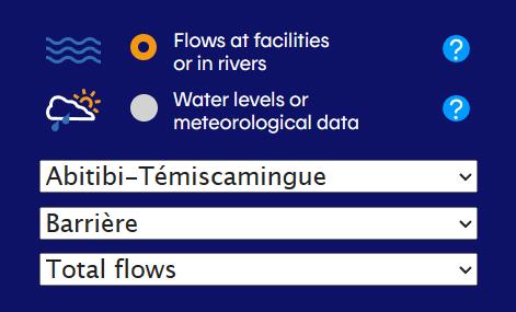
Locations to display: River locations only | Reservoirs only | Other locations
This map includes markers showing the location of gauges for which information on flows and water levels is available. This information is used for the integrated management of the principal reservoirs within the Ottawa River Basin.
For more information on the Terms of Use of this map, please visit the "About this map" section below.
Current Conditions
(2026-06-25 03:00:00)
(2026-06-25 03:00:00)
Current Conditions
(2026-06-25 03:00:00)
(2026-06-25 03:00:00)
Current Conditions
(2026-06-25 03:00:00)
(2026-06-25 03:00:00)
Current Conditions
(2026-06-25 03:00:00)
(2026-06-25 03:00:00)
Current Conditions
(2026-06-25 03:00:00)
(2026-06-25 03:00:00)
Current Conditions
(2026-06-25 00:00:00)
(2026-06-25 00:00:00)
Current Conditions
(2026-06-25 03:00:00)
(2026-06-25 03:00:00)
Current Conditions
(2026-06-25 02:00:00)
(2026-06-25 02:00:00)
Current Conditions
(2026-06-25 03:00:00)
(2026-06-25 03:00:00)
Current Conditions
(2026-06-25 00:00:00)
(2026-06-25 00:00:00)
Current Conditions
(2026-06-25 03:00:00)
(2026-06-25 03:00:00)
Current Conditions
(2026-06-25 03:00:00)
(2026-06-25 03:00:00)
Current Conditions
(2026-06-25 03:00:00)
(2026-06-25 03:00:00)
Reservoir Levels and Flows
| Water levels at 24:00h in metres and average flow (m3/s) | Reading type & Agency* |
2026-06-18 | 2026-06-19 | 2026-06-20 | 2026-06-21 | 2026-06-22 | 2026-06-23 | 2026-06-24 | 2026-06-25 |
|---|---|---|---|---|---|---|---|---|---|
| Dozois Graph View and Advanced Data | Level - HQ | 345.15 | 345.14 | 345.12 | 345.11 | 345.09 | 345.07 | 345.05 | 345.04 |
| Flow - HQ | 180 | 180 | 180 | 179 | 178 | 165 | 157 | 156 | |
| Rapide-7 Graph View and Advanced Data | Level - HQ | 309.11 | 309.09 | 309.08 | 309.06 | 309.06 | 309.05 | 309.05 | 309.05 |
| Flow - HQ | 280 | 315 | 315 | 314 | 285 | 257 | 258 | 259 | |
| Quinze Graph View and Advanced Data | Level - MELCC | 262.99 | 262.99 | 262.99 | 262.98 | 262.99 | 262.99 | 263.01 | 263.02 |
| Flow - MELCC | 458 | 454 | 456 | 455 | 423 | 371 | 348 | 348 | |
| Lady Evelyn Graph View and Advanced Data | Level - OPG | 289.10 | 289.12 | 289.12 | 289.12 | 289.14 | 289.14 | 289.14 | 289.15 |
| Flow - OPG | 10 | 7 | 7 | 8 | 8 | 8 | 8 | 8 | |
| Kipawa Graph View and Advanced Data | Level - MELCC | 269.56 | 269.56 | 269.54 | 269.53 | 269.53 | 269.49 | 269.49 | 269.49 |
| Flow - MELCC | 93 | 144 | 163 | 136 | 82 | 62 | 62 | 62 | |
| Timiskaming at Haileybury Graph View and Advanced Data | Level - WSC | 179.24 | 179.25 | 179.27 | 179.26 | 179.22 | 179.20 | 179.18 | 179.18 |
| Timiskaming at Temiscaming Graph View and Advanced Data | Level - WSC | 179.28 | 179.30 | 179.30 | 179.29 | 179.27 | 179.27 | 179.24 | 179.23 |
| Flow - PSPC | 770 | 776 | 785 | 771 | 761 | 673 | 608 | 589 | |
| Des Joachims Graph View and Advanced Data | Level - OPG | 152.14 | 152.17 | 152.15 | 152.14 | 152.12 | 152.19 | 152.16 | 152.15 |
| Flow - OPG | 895 | 943 | 972 | 963 | 990 | 888 | 812 | 424 | |
| Bark Lake Graph View and Advanced Data | Level - OPG | 313.85 | 313.81 | 313.78 | 313.74 | 313.74 | 313.74 | 313.73 | 313.72 |
| Flow - OPG | 60 | 72 | 71 | 70 | 55 | 45 | 44 | 44 | |
| Cabonga Graph View and Advanced Data | Level - HQ | 360.40 | 360.40 | 360.39 | 360.38 | 360.37 | 360.38 | 360.37 | 360.36 |
| Flow - HQ | 45 | 45 | 45 | 45 | 44 | 44 | 44 | 44 | |
| Baskatong Graph View and Advanced Data | Level - HQ | 221.57 | 221.57 | 221.57 | 221.57 | 221.59 | 221.57 | 221.56 | 221.57 |
| Flow - HQ | 247 | 230 | 221 | 221 | 221 | 219 | 218 | 218 | |
| Mitchinamecus Graph View and Advanced Data | Level - MELCC | 381.36 | 381.37 | 381.38 | 381.39 | 381.41 | 381.41 | 381.41 | 381.42 |
| Flow - MELCC | 10 | 10 | 10 | 10 | 10 | 12 | 12 | 12 | |
| Kiamika Graph View and Advanced Data | Level - MELCC | 268.01 | 268.01 | 268.02 | 268.02 | 268.02 | 268.02 | 268.01 | 268.00 |
| Flow - MELCC | 17 | 17 | 17 | 17 | 17 | 17 | 17 | 16 | |
| Poisson Blanc Graph View and Advanced Data | Level - MELCC | 201.21 | 201.23 | 201.28 | 201.32 | 201.34 | 201.35 | 201.34 | 201.33 |
| Flow - EG | 176 | 169 | 133 | 118 | 135 | 160 | 169 | 170 |
*Agencies
HQ – Hydro Québec
MELCCFP – Ministère de l’Environnement, de la Lutte contre les changements climatiques, de la Faune et des Parcs
PSPC – Public Services and Procurement Canada
OPG – Ontario Power Generation
WSC – Water Survey Canada
EG – Evolugen
VG – City of Gatineau
RVCA – Rideau Valley Conservation Authority
MVCA – Mississippi Valley Conservation Authority
River Conditions Forecast
Additional content
About this map
This map includes markers representing the location of gauges where information on flows and water levels are available. Data collected at gauges shown on the ‘River locations only’ and ‘Reservoirs only’ maps is used for the integrated management of the principal reservoirs within the Ottawa River Basin.
Instruction:
The coloured markers on this map depict conditions (level or flow) as a range of conditions categorized in three groups: ![]() for normal conditions,
for normal conditions, ![]() for above normal,
for above normal, ![]() for below normal. The marker is
for below normal. The marker is ![]() when the current day’s value or percentile are not available, or when the flow is zero m3/s. On the ‘River locations only’ map, the colour of the markers for locations with run-of-river facilities is based on flow conditions. On the ‘Reservoirs only’ map, the marker colour for all locations is based on the water level in the reservoir.
when the current day’s value or percentile are not available, or when the flow is zero m3/s. On the ‘River locations only’ map, the colour of the markers for locations with run-of-river facilities is based on flow conditions. On the ‘Reservoirs only’ map, the marker colour for all locations is based on the water level in the reservoir.
Click on any marker to see the most recent data from this location and what type of data is measured there. To view data related to the principal reservoirs in the basin, select ‘Reservoirs only’ in the upper right corner. Near real-time and historical data is available for additional locations by selecting ‘Graph View and Advanced Data’. Water levels at 24:00 means at midnight.
Terms of Use:
The data provided by this web service may not be reproduced or redistributed. Contact the Ottawa River Regulation Secretariat for information on how to obtain historical data directly from the data owner.
Users of the flow data, water level data, and hydrological forecasts shown on this website must recognize that such information is considered preliminary data. Users must therefore accept that the information provided carries an unspecified level of uncertainty and are advised to be cautious if they intend to use the information for decision-making. Please see the disclaimer for further details.
The flow rates and actual levels can change rapidly without warning, particularly during the freshet period. We advise those using bodies of water to exercise caution and to always follow established safety guidelines when near water.
Understanding Range of Conditions:
The three ranges are based on percentiles, which are computed from the observations of the current day of the year over a period of 30 years (1991-2020). The percentile (P) is the percent of all data that is lower than the actual value for the current day of the year.
![]() : Normal conditions, between P10% and P90%
: Normal conditions, between P10% and P90%
![]() : Above normal conditions, P is equal or greater than P90%
: Above normal conditions, P is equal or greater than P90%
![]() : Below normal conditions, P is lower than P10%
: Below normal conditions, P is lower than P10%
![]() : Current day value or percentile not available, or flow of zero m3/s
: Current day value or percentile not available, or flow of zero m3/s