Current Conditions
Publication: 2025-11-02
Snow MapSnow Water Equivalent
The map of the snow water equivalent can be found by clicking here.
This map gives an overview, at the time of measurements, of the amount of water held in the snow cover compared to the amount of water it normally holds at this same time of year. The map covers the entire Ottawa River watershed. At a glance, it is possible to see if there is more or less snow than usual.
It is important to note that the amount of water in the snow cover is only one of several factors that can influence the magnitude of the spring freshet. For more information on the factors that contribute to flooding, please consult our Frequently Asked Questions.
This map is updated approximately every two weeks in the period before and during the spring freshet.
Warning
Please note that recent snowfalls or thaws that have caused an increase in snow cover or melting of part of the snow cover may not have been represented in the map. Therefore, the conditions shown on the map may not perfectly reflect current field conditions.
Reference
To reference this map, please use ‘Ministère de l’Environnement et de la Lutte contre les changements climatiques, 2022. Data from the Réseau de surveillance du climat du Québec, Direction de la qualité de l’air et du climat, Québec.’
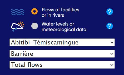
Locations to display: River locations only | Reservoirs only | Other locations
Current Conditions
(2025-11-02 04:00:00)
(2025-11-02 00:00:00)
Current Conditions
(2025-11-02 04:00:00)
(2025-11-02 04:00:00)
Current Conditions
(2025-11-02 04:00:00)
(2025-11-02 04:00:00)
Current Conditions
(2025-11-02 00:00:00)
(2025-11-02 04:00:00)
Current Conditions
(2025-11-02 04:00:00)
(2025-11-02 04:00:00)
Current Conditions
(2025-11-02 00:00:00)
(2025-11-02 00:00:00)
Current Conditions
(2025-11-02 08:00:00)
(2025-11-02 08:00:00)
Current Conditions
(2025-11-02 07:00:00)
(2025-11-02 06:00:00)
Current Conditions
(2025-11-02 04:00:00)
(2025-11-02 04:00:00)
Current Conditions
(2025-11-02 00:00:00)
(2025-11-02 00:00:00)
Current Conditions
(2025-11-02 04:00:00)
(2025-11-02 04:00:00)
Current Conditions
(2025-11-02 04:00:00)
(2025-11-02 04:00:00)
Current Conditions
(2025-11-02 04:00:00)
(2025-11-02 04:00:00)
Reservoir Levels and Discharges
| Water levels at 24:00h in metres and average discharge (m3/s) | Reading type & Agency* | 2025-10-26 | 2025-10-27 | 2025-10-28 | 2025-10-29 | 2025-10-30 | 2025-10-31 | 2025-11-01 | 2025-11-02 |
|---|---|---|---|---|---|---|---|---|---|
| DozoisGraph View and Advanced Data | Level - HQ | 342.33 | 342.30 | 342.29 | 342.25 | 342.22 | 342.16 | 342.14 | – |
| Discharge - HQ | 145 | 144 | 144 | 143 | 142 | 142 | 142 | – | |
| Rapide-7Graph View and Advanced Data | Level - HQ | 308.64 | 308.64 | 308.64 | 308.63 | 308.62 | 308.59 | 308.58 | – |
| Discharge - HQ | 159 | 159 | 158 | 159 | 159 | 159 | 160 | – | |
| QuinzeGraph View and Advanced Data | Level - MELCC | 262.40 | 262.39 | 262.39 | 262.38 | 262.37 | 262.35 | 262.34 | – |
| Discharge - MELCC | 210 | 210 | 211 | 202 | 206 | 205 | 206 | – | |
| Lady EvelynGraph View and Advanced Data | Level - OPG | 289.02 | 289.02 | 289.02 | 289.02 | 289.02 | 289.02 | 289.02 | – |
| Discharge - OPG | 5 | 5 | 5 | 5 | 5 | 5 | 5 | – | |
| KipawaGraph View and Advanced Data | Level - MELCC | 269.07 | 269.06 | 269.06 | 269.02 | 269.02 | 268.99 | 268.99 | – |
| Discharge - MELCC | 26 | 26 | 26 | 15 | 15 | 15 | 15 | – | |
| Timiskaming at HaileyburyGraph View and Advanced Data | Level - WSC | 178.34 | 178.32 | 178.31 | 178.29 | 178.27 | 178.24 | 178.21 | – |
| Timiskaming at TemiscamingGraph View and Advanced Data | Level - WSC | 178.40 | 178.37 | 178.37 | 178.37 | 178.35 | 178.38 | 178.32 | – |
| Discharge - PSPC | 373 | 387 | 407 | 395 | 394 | 397 | 385 | – | |
| Des JoachimsGraph View and Advanced Data | Level - OPG | 152.07 | 152.07 | 152.07 | 152.08 | 152.07 | 152.11 | 152.11 | – |
| Discharge - OPG | 419 | 410 | 438 | 422 | 418 | 480 | 436 | – | |
| Bark LakeGraph View and Advanced Data | Level - OPG | 312.96 | 312.94 | 312.94 | 312.92 | 312.91 | 312.92 | 312.91 | – |
| Discharge - OPG | 12 | 12 | 11 | 11 | 11 | 11 | 11 | – | |
| CabongaGraph View and Advanced Data | Level - HQ | 359.48 | 359.47 | 359.47 | 359.47 | 359.47 | 359.49 | 359.50 | – |
| Discharge - HQ | 8 | 8 | 8 | 8 | 8 | 8 | 8 | – | |
| BaskatongGraph View and Advanced Data | Level - HQ | 218.59 | 218.57 | 218.55 | 218.51 | 218.49 | 218.47 | 218.45 | – |
| Discharge - HQ | 150 | 150 | 149 | 150 | 149 | 143 | 134 | – | |
| MitchinamecusGraph View and Advanced Data | Level - MELCC | 378.88 | 378.86 | 378.85 | 378.81 | 378.79 | 378.80 | 378.79 | – |
| Discharge - MELCC | 25 | 25 | 25 | 23 | 23 | 24 | 24 | – | |
| KiamikaGraph View and Advanced Data | Level - MELCC | 267.23 | 267.22 | 267.22 | 267.21 | 267.21 | 267.25 | 267.28 | – |
| Discharge - MELCC | 6 | 6 | 6 | 6 | 6 | 7 | 9 | – | |
| Poisson BlancGraph View and Advanced Data | Level - MELCC | 198.67 | 198.68 | 198.68 | 198.70 | 198.71 | 198.77 | 198.82 | – |
| Discharge - EG | 51 | 51 | 50 | 51 | 46 | 40 | 40 | – |
*Agencies
HQ – Hydro Québec
MELCC – Ministère de l’Environnement et de la Lutte contre les changements climatiques
PSPC – Public Services and Procurement Canada
OPG – Ontario Power Generation
WSC – Water Survey Canada
EG – Evolugen
VG – City of Gatineau
RVCA – Rideau Valley Conservation Authority
MVCA – Mississippi Valley Conservation Authority
River Conditions Forecast
Water levels and flows along the main stem of the Ottawa River are below average at most locations for this time of year resulting from below-normal precipitation across the watershed over several consecutive weeks. Water levels and flows are expected to slightly increase or remain fairly stable depending on locations over the coming week. At some locations, water levels are below navigational chart datums. Please take note of an important message from the ORRPB that is posted on the website Home page in the SPECIAL FEATURE section.
Additional content
About this map
This map includes markers representing the location of gauges where information on flows and water levels are available. Data collected at gauges shown on the ‘River locations only’ and ‘Reservoirs only’ maps is used for the integrated management of the principal reservoirs within the Ottawa River Basin.
Instruction:
The coloured markers on this map depict conditions (level or flow) as a range of conditions categorized in three groups: ![]() for normal conditions,
for normal conditions, ![]() for above normal,
for above normal, ![]() for below normal. The marker is
for below normal. The marker is ![]() when the current day’s value or percentile are not available.
when the current day’s value or percentile are not available.
Click on any marker to see the most recent data from this location and what type of data is measured there. To view data related to the principal reservoirs in the basin, select ‘Reservoirs only’ in the upper right corner. Near real-time and historical data is available for additional locations by selecting ‘Graph View and Advanced Data’. Water levels at 24:00 means at midnight.
Terms of Use:
The data provided by this web service may not be reproduced or redistributed. Contact the Ottawa River Regulation Secretariat (see Contact us) for information on how to obtain historical data directly from the data owner.
Users of flow data and water level data shown on this website are cautioned to consider the unverified nature of the information before using it for decisions making. Please see the Disclaimer for further details.
The flow rate and actual levels can change rapidly without warning, particularly during the freshet period. We advise those using bodies of water to exercise caution and to follow safety rules at all times.
Understanding Range of Conditions:
The three ranges are based on percentiles, which are computed from the observations of the current day of the year over the last 30 years. The percentile (P) is the percent of all data that is lower than the actual value for the current day of the year.
![]() : Normal conditions, between P25% and P75%
: Normal conditions, between P25% and P75%
![]() : Above normal conditions, P is equal or greater than P75%
: Above normal conditions, P is equal or greater than P75%
![]() : Below normal conditions, P is lower than P25%
: Below normal conditions, P is lower than P25%
![]() : Current day value or percentile not available
: Current day value or percentile not available